New Geographic Information Science minor offers unique opportunities
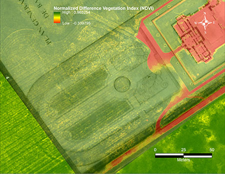
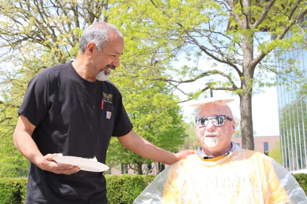
Photo courtesy of Oakland University News
Drone imagery utilizing GIS software.
There is a new minor at Oakland University, introduced in August 2021. The Geographic Information Science (GIS) minor is a 20 credit minor situated in the Department of Anthropology, Sociology, Social Work and Criminal Justice.
GIS is a rapidly growing field. The technology and science behind GIS brings geography into all careers. The comprehensive knowledge of the GIS minor makes students competitive for careers. Students will have a healthier career outlook and stronger job security.
Associate Professor of Anthropology Jon Carroll, Professor of Environmental Science Jonathan Weyhrauch and GIS student Nicholas Psenicka spoke about the minor and internship possibilities.
“What makes us different at Oakland, is that we not only teach the science and software, we show students how to take the knowledge out into the world and do things with it,” Caroll said. “Theories, methods, science and techniques are each part of the GIS software — there is great flexibility in this minor and the usage of the technology.”
The three core courses for the minor are:
AN 3800 — Intro to Geographic Information Systems
AN 3801 — Principles of Cartography
AN 3802 — Satellite Photography
The science and technology from GIS is used in navigation systems, traffic engineering, meteorology, agriculture, environmental science and sociology. The minor is open to substitutions from other courses, as well as internships or research for a capstone project.
The mapping technology of GIS allows for topographic and cartographic analysis of urban and rural environments. With the advent of affordable drone technology, many businesses and nonprofits are utilizing this technology to economically innovate and grow.
Weyhrauch is the founder of Reroot Pontiac. Reroot Pontiac is a local non-profit that focuses on creating sustainable technology and green infrastructure that offers numerous internship opportunities.
“The educational value of a GIS minor translates into great internship and employment opportunities,” Weyhrauch said. “Reroot Pontiac has been using this technology for specific mapping of our orchards and the mapping of food deserts.”
GIS technology is used in the mapping of climate change and the area effects that infrastructure has had. The placement of businesses such as Starbucks rely on this technology to help them determine locations which are high traffic. Using drones and satellite imagery to create maps has unlimited uses.
Psenicka, an intern at Reroot Pontiac minoring in GIS, developed a map showing the construction of the DOW chemical containment pond from the years 1953, 1959, 1973 and 2020.
“A picture may be worth a thousand words, but a map is worth a million,” Psenicka said. “I feel very confident in the education I am receiving from this minor, Dr. Carroll is an outstanding professor.”
There is a lot of versatility in a myriad of majors. A background in GIS gives students the ability to solve complex problems and develop new perspectives through geographic spatial analysis. Students who are majoring in public health and public administration can use this technology to help with zoning and land applications. Students majoring in women and gender studies can use this information to help with urban planning and develop.