
Flying high while also helping communities
Drone program helps with agriculture in Africa
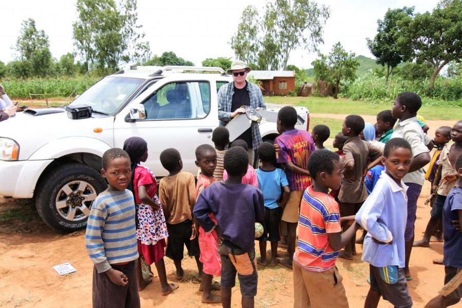
An Oakland University professor and a Michigan State University graduate student were part of a team using drones for research in Africa. Doctor Jon Carroll of Oakland was chosen to work on the the project because of his expertise in unmanned flying objects such as drones. Carroll is a Registered Professional Archaeologist, FAA-licensed drone pilot and assistant professor in OU’s Department of Sociology, Anthropology, Social Work and Criminal Justice.
“What’s going to be useful is that there are a lot of sophisticated but accessible technology out there,” Carroll said. “[This] allows us to make decisions of what’s best to move forward.”
The project is titled “Precision Agriculture for Smallholder Systems in Africa,” and is a part of Feed the Future. Feed the Future is a United States government global hunger and food security initiative.
This initiative and project is funded by the U.S. Agency for International Development (USAID). It is in collaboration with Michigan State’s Center for Global Change and Earth Observations and Kansas State University’s Sustainable Intensification Innovation Lab.
Carroll is typically involved with archeology abroad. He was chosen because he was a part of Center for Global Change during his time as a graduate student at Michigan State.
Brad Peter, a MSU graduate student, involved with this project, which took place in Malawi which is a landlocked country on the east side of the African continent parallel with Madagascar.
“I initially became involved in this project after taking a geocomputation course with my now adviser, Doctor Joseph Messina,” Peter said. “I have always enjoyed answering “where” questions using geospatial techniques, and he approached me with an opportunity to join a project investigating where marginal agricultural lands in Malawi exist and what makes them marginal.”
The drones were specifically used to map the land both geographically and precisely. The mapping was used primarily for finding where the best land to farm was. The drone could produce graphs which showed were the most water and healthy soil were located. This is Carroll’s first experience with his drones being used for agriculture.
According to Peter, Malawi has very diverse geomorphology, also known as the physical features of the surface of the earth and their relation to its geological structures. Malawi has one of the largest freshwater lakes in the world and is home to many mountains.
“Aside from the beauty, Malawi is facing issues associated with shifting rainfall patterns, soil degradation, population growth and food security,” Peter stated. “Being a geographer, I see immense value in maps and spatial data and enjoy using such techniques to tackle pressing world problems.”
The drones also make it so different researchers can download the video. This way they can view what the group has seen first hand. According to Carroll, he is continually working on different kinds of analysis, with different fields and areas to tie together into a larger picture. This way the videos and the drones can tie into a solution to agricultural difficulties in Malawi.
“It’s a great place to conduct research and is known rightfully as the ‘warm heart of Africa’,” Peter said.